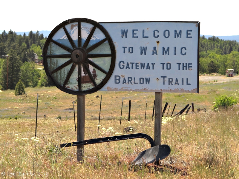
The city of Wamic is a census-designated place and unincorporated community in Wasco County, Oregon.
Wamic was named for the Womack family (Asa Womack, Levi Womack and their Nephew Crawford), which settled the area.
The Post Office was established Nov 25, 1884 with James W. Sanford as postmaster. It closed in 1958.
The population of Wamic was 36 at the 2000 census.
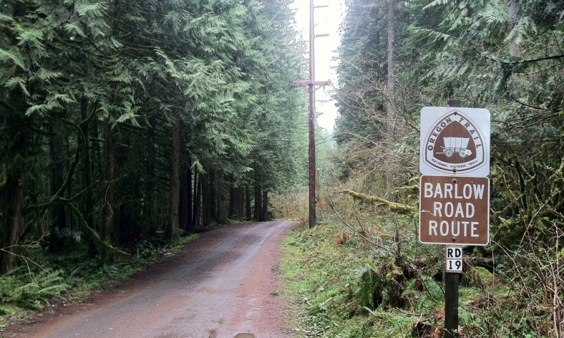
Wamic is also known as the Gateway to the Barlow Trail.
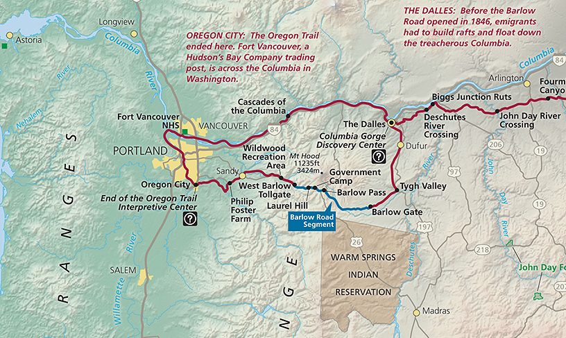
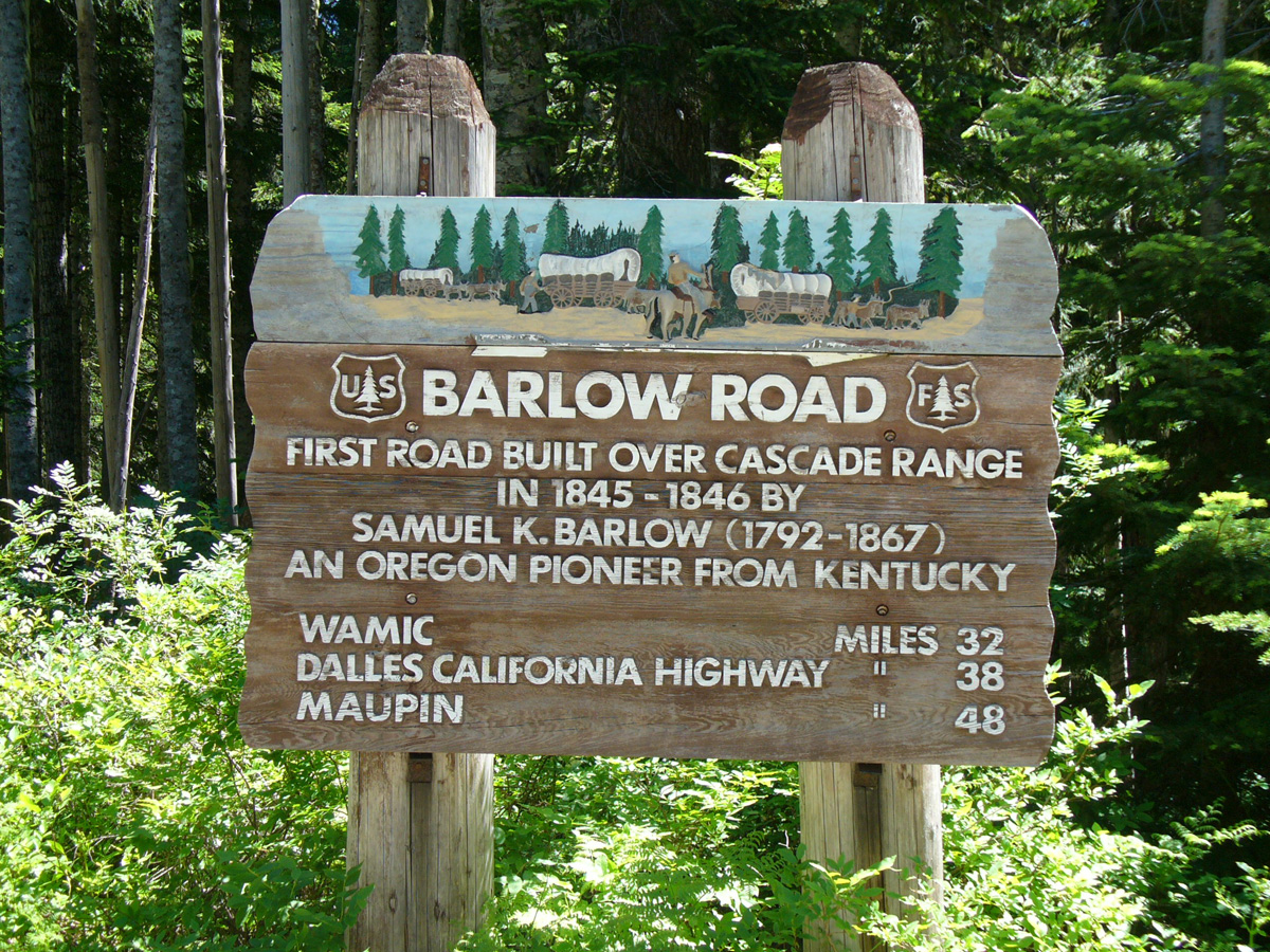
The Barlow Road is a branch of the Oregon Trail. Opened in 1846 by Sam Barlow and Philip Foster after authorization by Oregon's provisional Legislature, it stretched 100 miles from Tygh Valley to Eagle Creek.
Its construction allowed covered wagons and livestock to avoid the expensive and perilous float trip down the Columbia River from The Dalles by going up and over the Cascades to the Willamette Valley. This saved emigrants as much as a week of travel time.
Previously, emigrants traveled to The Dalles, then followed an ancient Indian trail south from The Dalles to Tygh Valley. In Tygh Valley, emigrants caught the Barlow Road and followed it over the Cascades to Oregon City.
Oregon Trail emigrant and diarist Riley Root first mentions Cutoff in 1848, by which time it was apparently already well established. In the years that followed, the Cutoff was used extensively by Oregon Trail emigrants.
“On the top of this bluff, the road divides, one leading to the Columbia River. The other, at the left, is the one we took.” - Riley Root, 1848
According to the History of Central Oregon, the Barlow Cutoff...
“...was called the Old Emigrant Road and Road in Ravine. The route was established and was being used increasingly by the emigrants -- especially those with animals. The toll over the Barlow Road was $5 a wagon and 10 cents per animal... It entered [Sherman] county one mile below Leonard's bridge, climbed the hill in a southwesterly direction, paralleled Grass Valley canyon until near the present site of Grass Valley, where it entered the canyon and continued southwesterly to Buck Hollow. The emigrants ferried themselves across the Deschutes on wagon boxes one mile north of Sherar's Bridge.”
During the Barlow Road's first season of operation -- at an authorized toll of $5 per wagon and 10 cents for each head of livestock -- Barlow recorded more than 1,000 people, 150 wagons and 2,800 animals using the road.
Barlow's concession expired in 1848 and he ended his partnership with Foster. During the next 60 years the toll concession was sold several times and moved slowly west, ending in 1879 just east of Rhododendron.
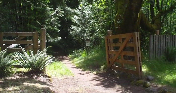
The last toll gate standing on The Barlow Road.